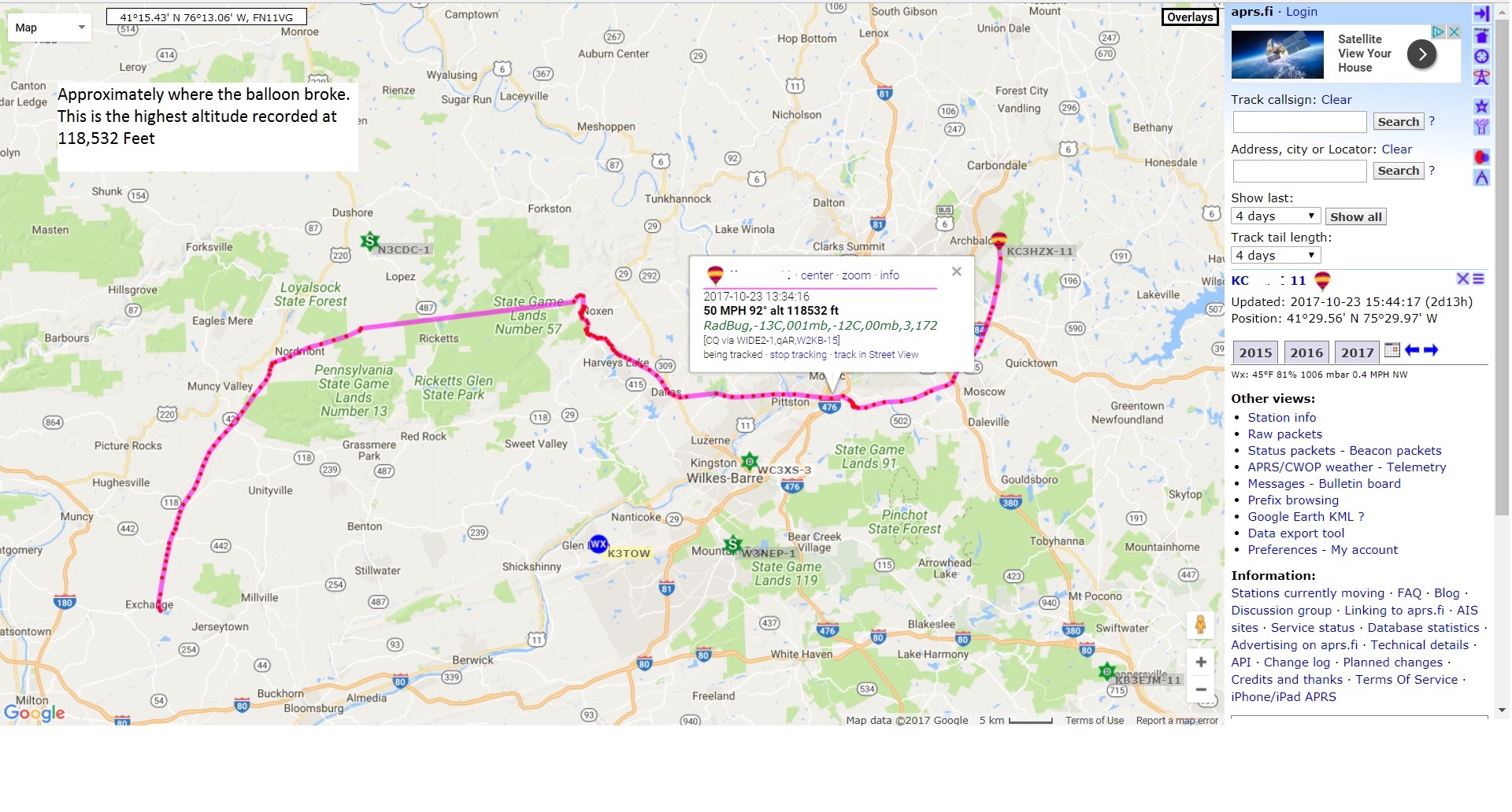


The video clip below shows the time when the balloon burst at an height of ~118,000 feet. The payload was satellite tracking, Go-Pro, 2 meter HAM radio transmitting data back, on the APRS protocol, temperature and pressure sensors. The map image below the video shows the path the balloon took while in flight. The mapping shows the tracking of the balloon via HAM radio protocol (APRS), in addition APRS transmitted and logged sensor data. This was the second successful flight in the past few years. My part of these projects is to assist the science teacher on the radio and sensor data collection. We had built a few payload prototypes using the RaspberryPi. The Pi and the Python programming language allowed us to capture GPS satellite data, temperature and other sensor data. Check out my BLOG post on our first flight here... For the full video click here